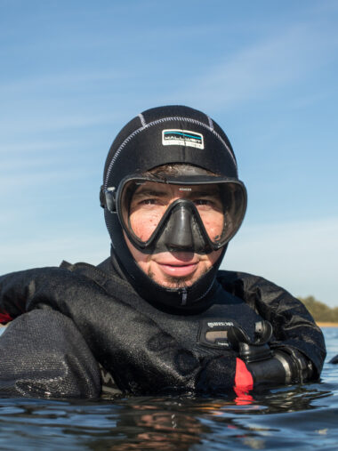
Usual Monday
It was just a usual training dive on a Monday evening in May 2019. We cruised out around 7 pm with my small boat to play around a little with the Seacraft Future 750 and the then quite new Electronic Navigation Console 2 from Seacraft (ENC2). The ENC2 allows to navigate more precisely and even refind your starting point – within certain limits. Or, what became very important later, relocate interesting waypoints saved during the dive!
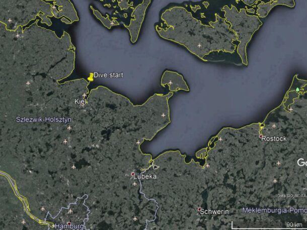
That day, we decided to dive at an archaeological excavation site from the New Stone Age (around 5000 BC) near the lighthouse “Bülk” at the entrance of the Kiel Fjord, Germany. You can always find nice stone tools there and, if lucky, even the odd speciality like axes, deer antlers, or even human remains. Of course, as trained scientific divers, who took part of the excavation from time to time, we would not take anything, but rather tell the leading archaeologist about our findings.
Ancient hunter's camp
The dive spot is easy and shallow, the bottom consists mainly of sand with eelgrass and boulders, covered by red algae. The depth is only around six metres, but 7000 years ago, this was a summer camp of hunters and gatherers, located at a beautiful, wooded lagoon, full of eel, seals, porpoise and cod, as findings from the excavation site showed.
As the light was fading, we got ready for the night dive. The plan was to examine the excavation site a little and check, whether after the spring storms new artifacts showed up. After that we wanted to just hit the throttle and scooter at least 20 minutes to the west (direction of the beach) to test the „Return to home“ function of the ENC2 and try to find our anchor in the bad visibility of the western Baltic Sea (visibility on that dive was less than two metres…).
Tire of aPlane ?
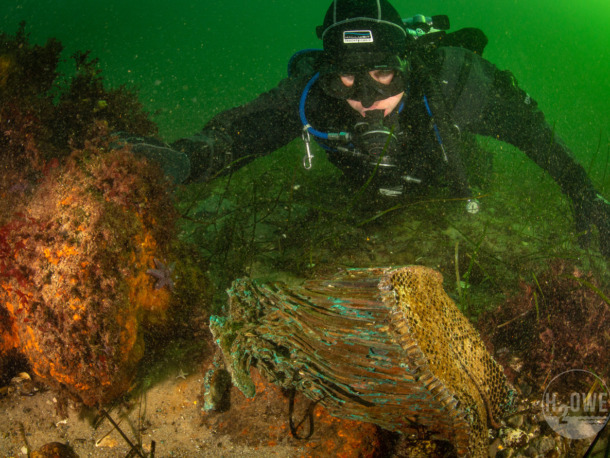
The short search at the excavation site didn’t reveal anything new (not newer than 7000 years, that is), so we decided to speed away and leave our fate to the ENC2 – the fate of finding back the anchor, at least. After about five minutes (Fig. 1), I found a peculiar looking rock of at least one metre in diameter and stopped. At closer inspection, I realised that it wasn’t a rock, but a big, broken rubber tire, now home to two big cods – and the tire had no profile! Could this be the tire of a plane?
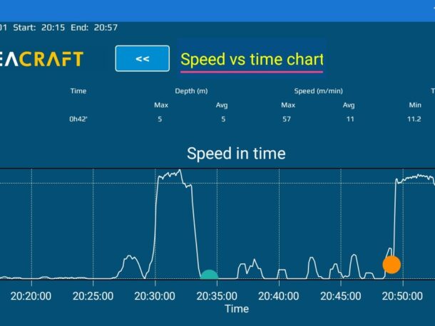
Fig. 1: Speed vs. time chart from the log file of the ENC2 of the dive in May. The way to (and from) the bomber took about 4-5 minutes from my last known position. I took two waypoints, one at the initial contact with the wreckage, the second when we left for the anchor again.
Story from the past
As a kid, I started diving at the age of six already thanks to my father, who is a passionate Baltic diver, a hobby archaeologist – and who owned a small boat. He told me of an english bomber, that went down near the lighthouse in the last days of World War II. It hit the water in a very steep angle…none of the crew members survived. He had heard the story from an eye-witness abord a refugee vessel from east prussia, who was a colleague of his at the fire station, where he worked his whole life. It was a dream of his to find this bomber – maybe to see, if the story he heard was true. We tried several times in the eighties and nineties to locate the bomber – back then by towing each other behind his little boat – but never saw even a glimpse of anything like a plane.
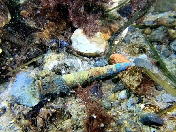
During the dive, when I started to survey the area, I soon realised, that this must be the long sought-after bomber: I found a lot of wires, aluminium, the second tire, two engine blocks (in-line, not radial, like from some american planes), cooling unit and, scattered over the whole area, thousands of bullets. The ammunition was too large for handweapons, they had to come from heavy machine guns.
How to come back?
Ok, now I obviously found the bomber, my father was looking for since decades. And I didn’t even bring a camera! So, would I be able to find it again later? Remember, it was already dark, I had no buoy nor GPS and my boat was too far away… At least I had the ENC2 on the scooter, so I chose to trust the interpolated positioning and, after a last look back to the huge tire, headed back to the boat.
Other projects became more important and urgent over the next months, so I only had a chance to try and relocate the bomber in August the same year. This time, I took my father with me! He still dives at 72, although less often now. This would be his first dive this year and he was excited, but mainly because of what I promised him to finally see for himself. I had read the ENC2 log file, exported it to the computer and set an anchor point at the known position of the excavation site. Following the scooters track on the screen, I estimated the position of the bomber, put it in my boat’s GPS plotter and hoped that it was acurate enough for the still less than three metre visibility.
Fig. 4: Part of one cooling unit and engine block (left). Photo by Christian Howe.
Found
We threw anchor at the estimated position of the huge tire…and missed it only by five metres! Thus, the ENC2 worked and even though I forgot to wait for a GPS position at the beginning of the dive in May, I managed to relocate the bomber. You can imagine, my father was quite happy with my navigation.
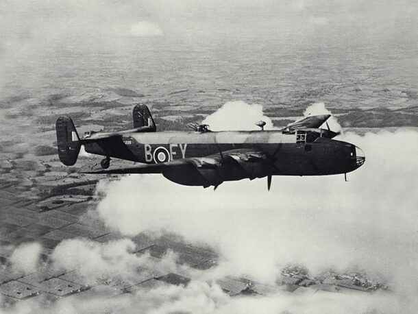
Since then, we have dived and examined the wreckage a few times, confirming that it actually hit the bottom in a very steep angle and that it was a four-engine flying fortress, presumably a Handley Page HALIFAX Mk II (Fig. 2) or an AVRO 683 LANCASTER, both carried a crew of seven. It had 8-9 machine guns, explaining the vast amount of ammunition we found (Fig. 3).
Fig. 2: A HALIFAX II bomber during WW2. Note the four in-line engines. Source: http://www.raf.mod.uk
Mystery remains
But some mysteries remain. For example, we didn’t find any human remains, but that could be due to the fact, that no real (paid) excavation took place so far. Also, two engines seemed to have been salvaged, maybe by looting divers, as we found modern ropes and carabiners fixed to one engine. And then, we don’t know until today, which plane really lies down there, as we didn’t find a serial number so far. The authorities (here, the State Agency for Archaeology) already knew of the existence and location of the plane, but only confided that knowledge upon my specific request about that wreck.
Fig. 3: One of the thousands of bullets that are scattered over the wreckage site.
Track from ENC2
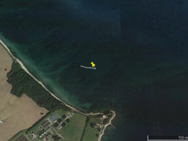
After uploading the dive log to Seacraft App, and exporting as .kml file, to review in for example Google Earth.
ENC2 - a silent dive partner
Overall, for me, under the given circumstances, it would have been very hard to discover (and relocate!) this chance find without the help of the Seacrafts Scooter and more importantly, the ENC2. Since then, when using the scooter, the ENC2 is a constant companion…
