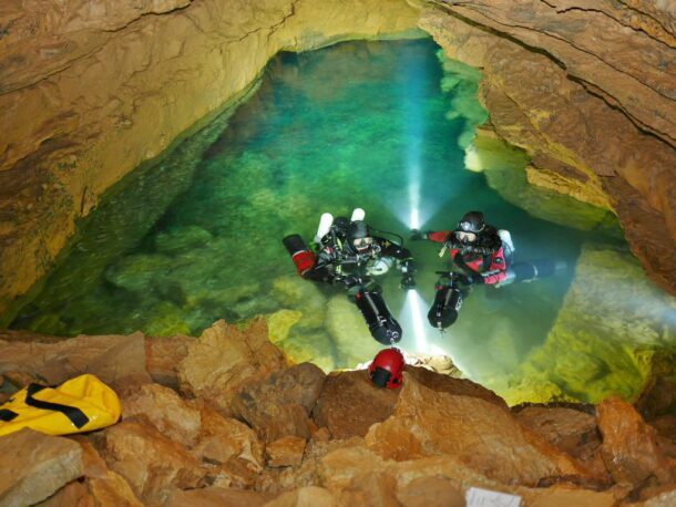
Emergence du Ressel is a faumous cave in LOT departament, France- with entrance is feeding water in the Céle river.
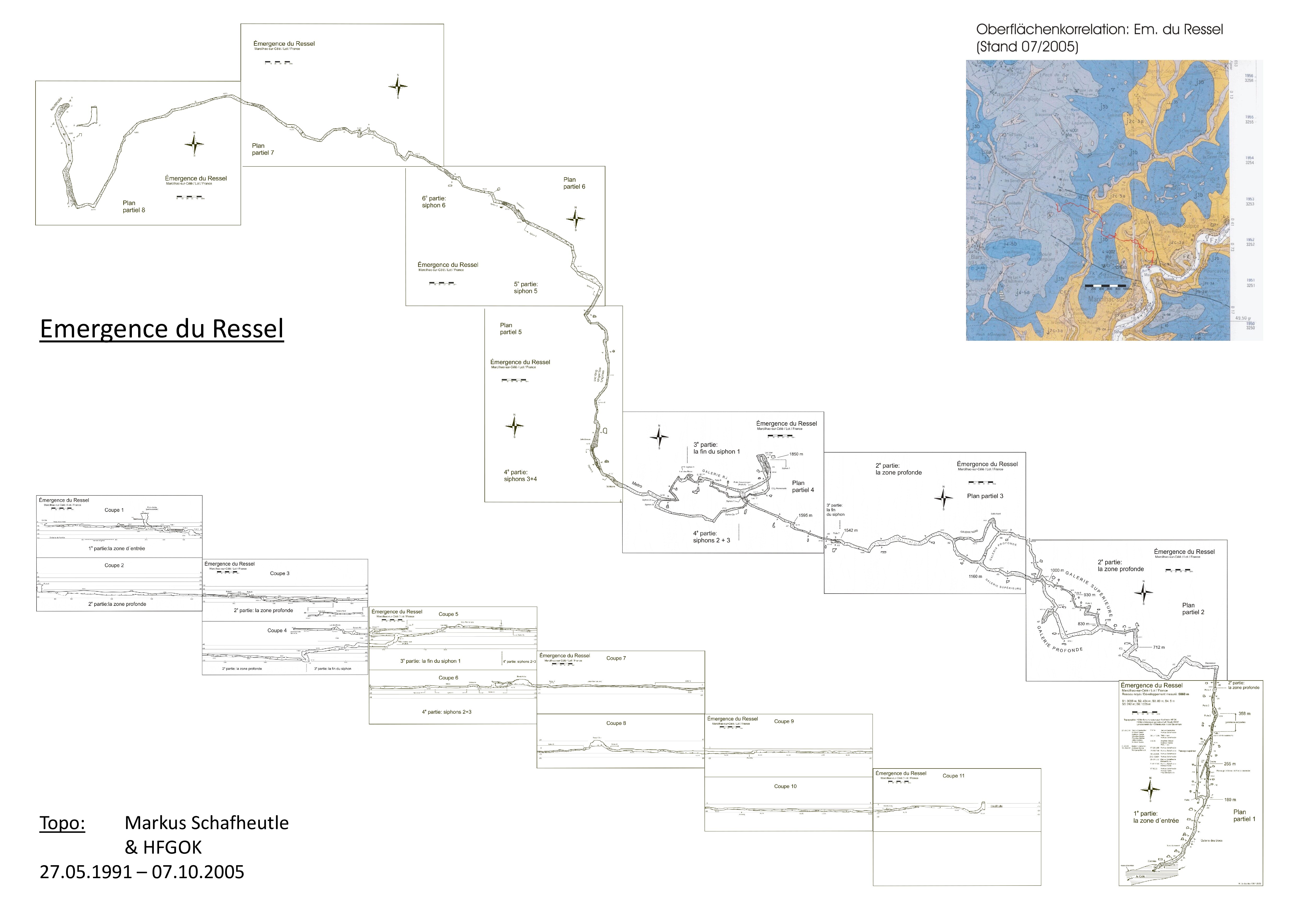
It’s complete survey and the topography took uncountable dives, and was completed over the course of 27.05.1991 –07.10.2005 by Markus Schafheutle& HFGOK.
Cave map can indicate a potentially interesting place to search- from the surface/ other near-by cave a connection, or easier access route.
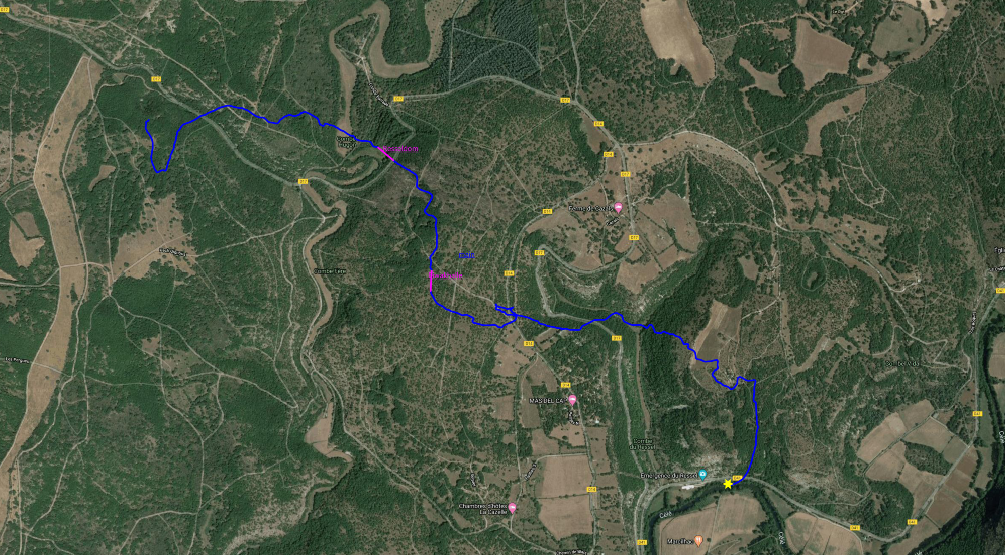
In this case, the very far- almost 5000m from the entrance- end of Ressel finished in “CreditHalle”, a boulder-choke located just under a big sinkhole.
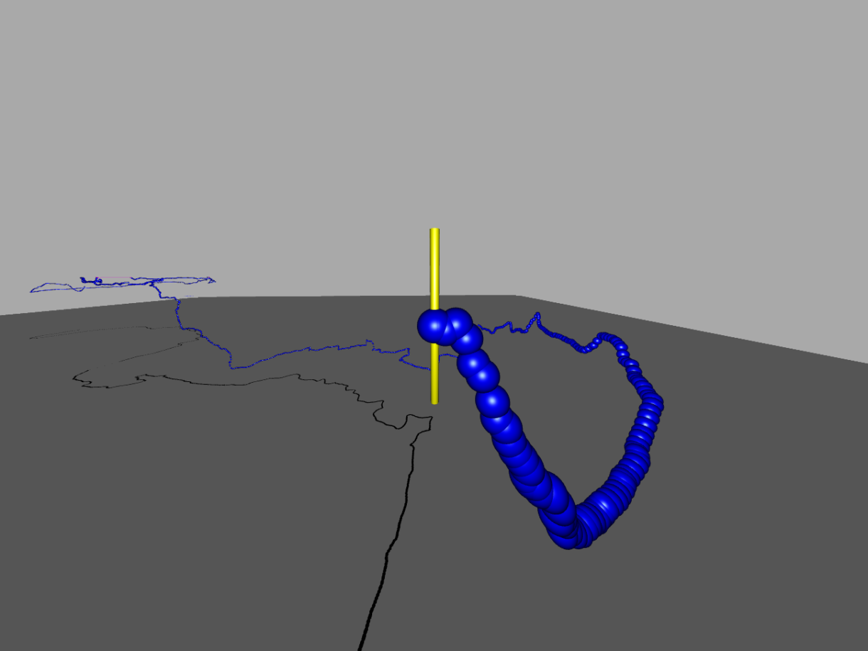
The team of Günter Faul and Pedro Balordi managed to make a survey of the whole polygon until Credithalle, on one dive- using ENC2 device.
The result is amazing even for Seacraft- as a manufacturer we only intended to create a navigational aid for divers, to help with navigation in cold, murky waters or ocean-infinite areas.
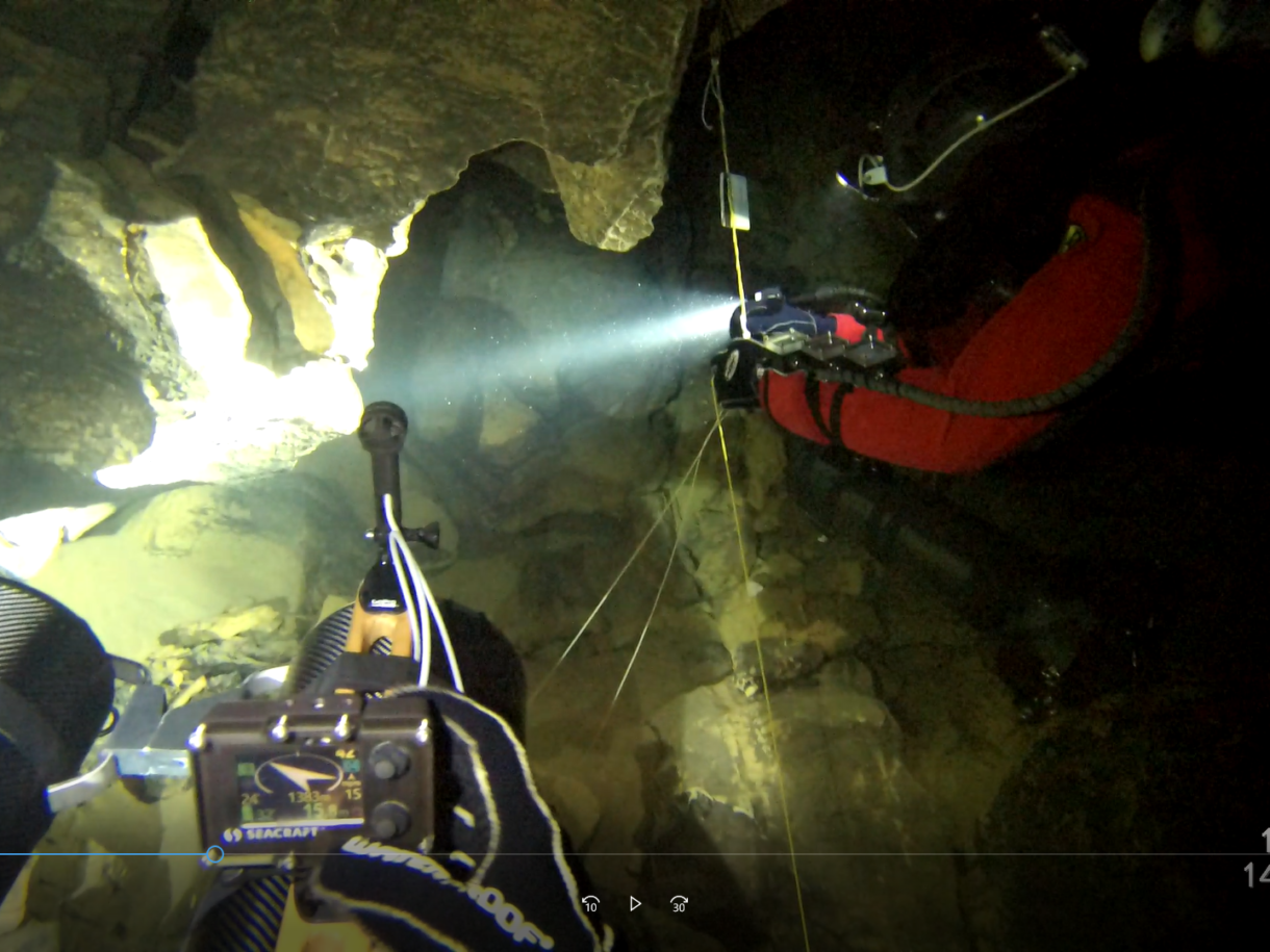
Last week Pedro Balordi and I dived again until the end of the Ressel to the “Credit Hall” (north tunnel). The goal was to search for continuations in the last siphon from the T-junction,where the passage splits into the north and south tunnel. At the same time we wanted to search again the fall at the end of the Ressel (lies under a big doline) for a possible passage through the boulder choke. Unfortunately, the result is that in our opinion there is definitely noway through the collapse. Not even with my idea to move the boulders mechanically. So the north tunnel is finally closed for us.
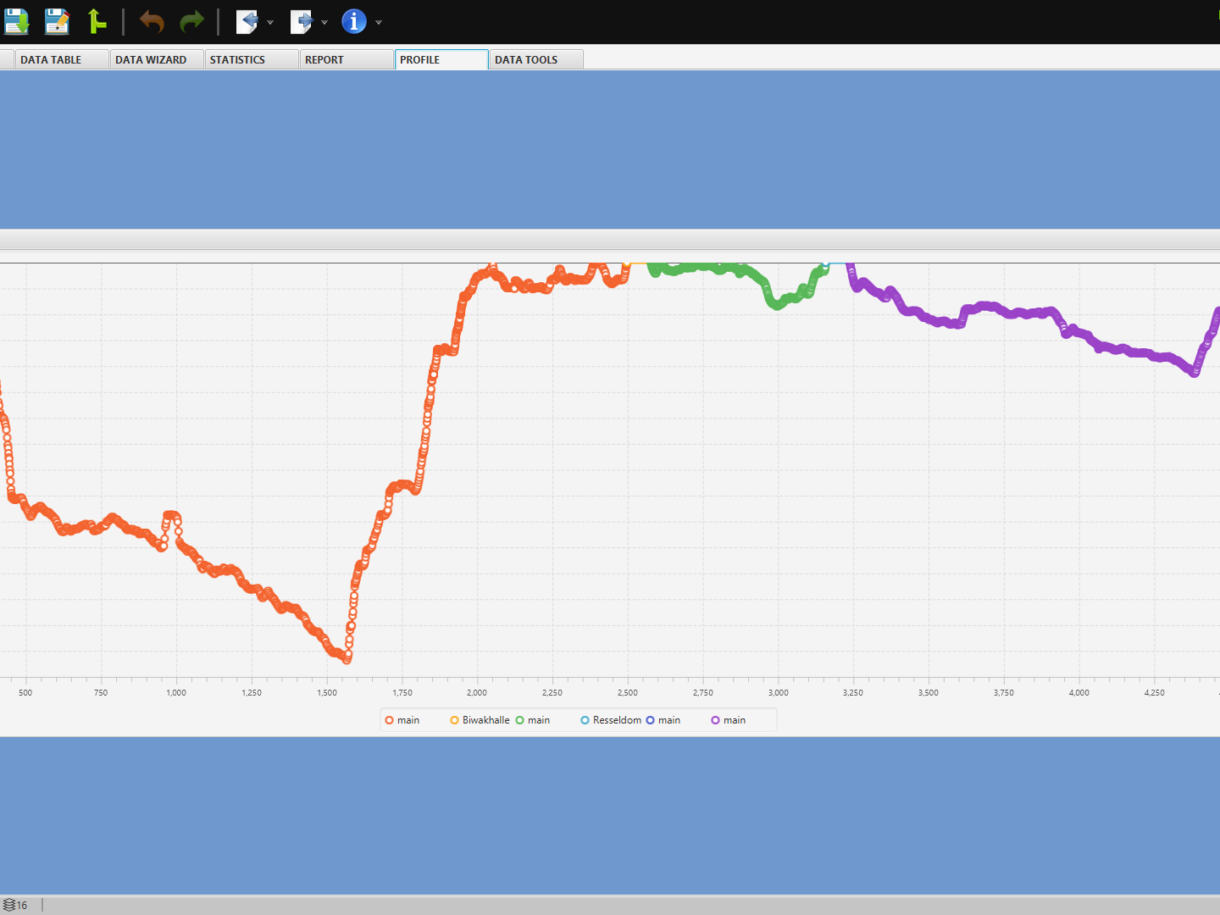
This time I had my Seacraft-ENC measuring device with me and measured the way to the “Credit Hall”. With the data from the Seacraft-ENC I then created a plan in the Arianesline program. After I had already surveyed the front part of the Oliero cave system (approx. 6000 m) this year, I was now curious about the results in the Ressel, because here I have with the perfect map of Markus Schafheutle a really good comparison how accurate the data is. When I had finished the map I was really surprised that the plan is pretty much the same as Markus, even the course of the passage ends exactly at the doline. When we come back again to have a look
at the south tunnel I hope that I have enough time to measure the remaining passages and then add them to the plan in Arianesline.Dive data:
We were on the way for 9 hours from the descent in the Céle to the resurface.
We dived as usual with our Kiss-Classik, SMIR and Kiss-Sidekick.
Fast and comfortable we were on the road with our twin’s of carbon scooters.
Perfect and comfortable for underwater and during transport in the dry parts were our SF-TECH dry suits.
Ressel survey's comparision
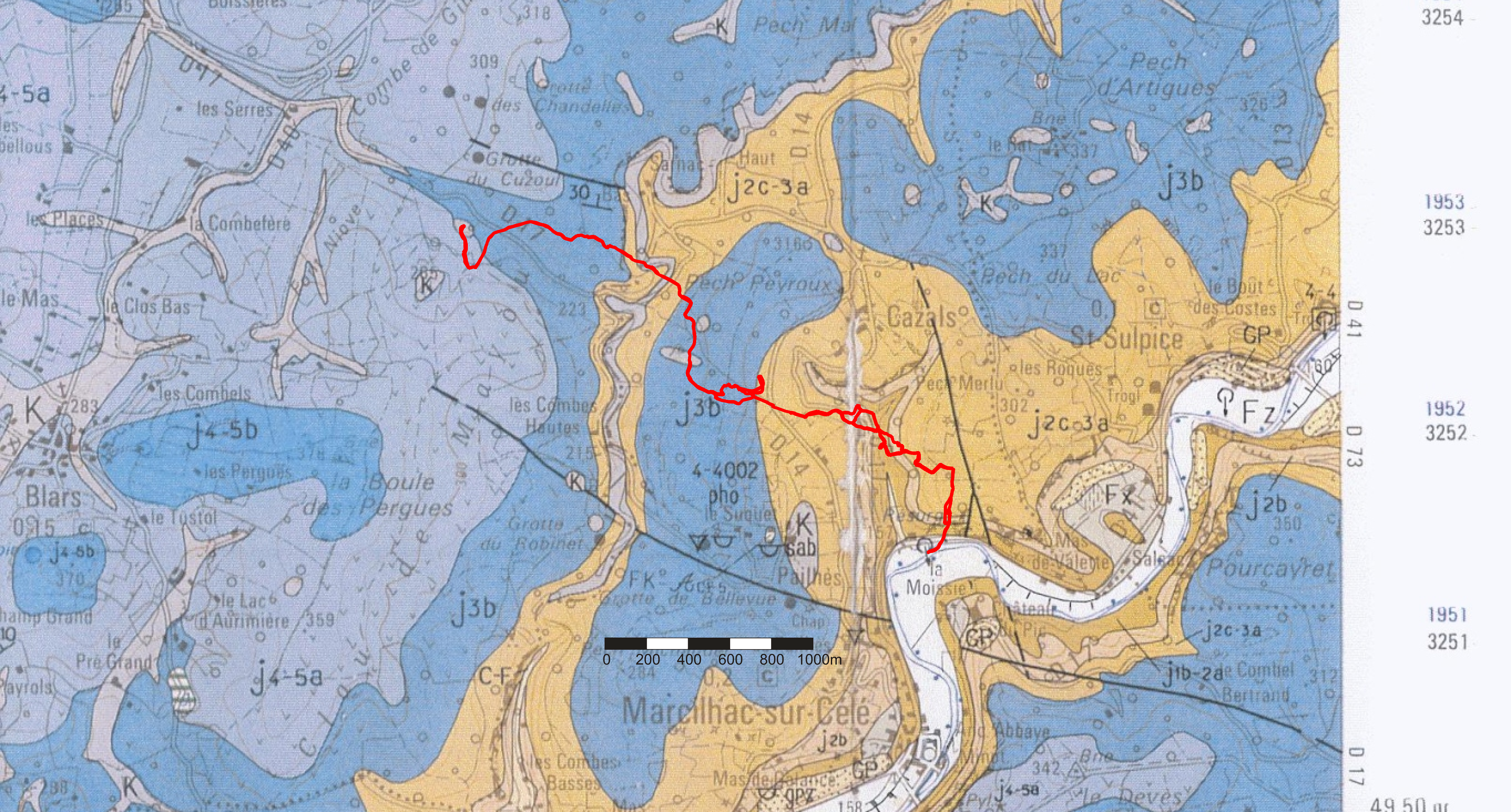
Marcus and HFGOK survey overlay on the geological map
ENC2 survey plot from Ariane's line program


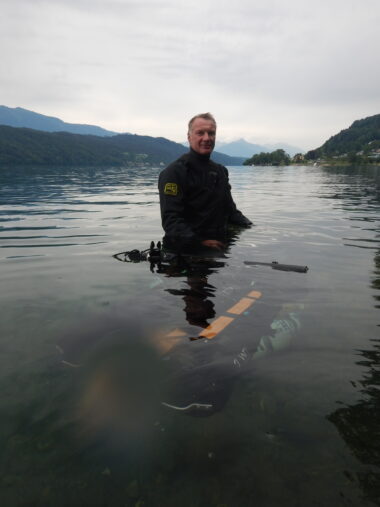
Günter Faul Emergence du Ressel
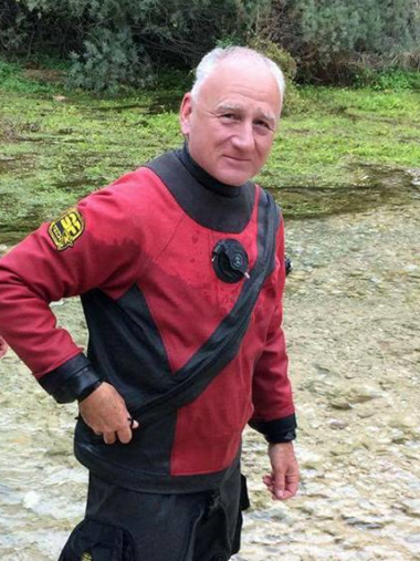
Pedro BalordiEmergence du Ressel
